Buy or gift a digital subscription and get access to the complete digital archive of every issue for just £18.99 / $23.99 / €21.99 a year.
Buy/gift a digital subscription Login to the Digital Edition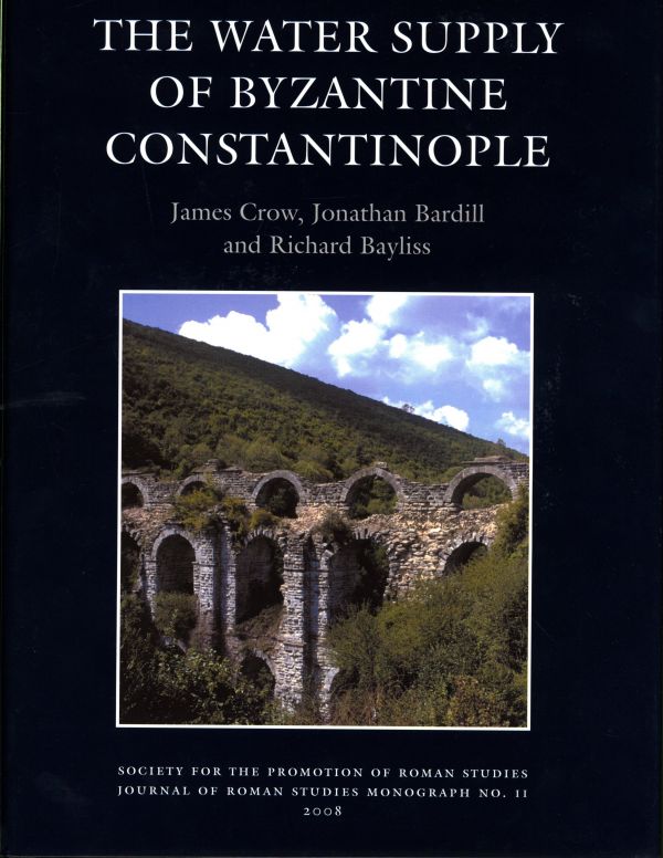
One of the greatest achievements of Roman hydraulic engineering, the water supply of Constantinople included the longest known aqueduct channels from the ancient world and the most complex system of water storage and distribution within the city itself. This monograph presents the results of ten years of fieldwork and research and provides a detailed account of the water channels and great bridges outside the city and the first comprehensive concordance of the water storage inside the city documenting over 150 cisterns. There is a historical introduction from Roman to early Ottoman times supported by a detailed collection of ancient sources translated into English. Later chapters integrate more closely the structural evidence with the written texts and provide the basis for new interpretations of the historical texts. Specific studies are concerned with the unique Christian iconography of the bridges and with the masons’ marks recorded from them. The volume is illustrated by detailed maps showing the course of the channels and the location of the water bridges, together with detailed elevation drawings of the great bridges in the wooded countryside outside the city. Within the city the cisterns are plotted in detail for the first time enabling an appreciation of the water system in its topographical setting.
For the English-speaking community of Istanbul the suggestion of aqueduct-hunting in Thrace strikes fear into the hearts of all but the foolhardy. For years, tours by the Friends of the American Research Institute seemed cursed to lose their way (as a group or individually), get stuck in the mud (usually by the busload), fall into the river (usually individually), or at the very least get rained on (without exception). Relentlessly cheerful, Prof James Crow of Edinburgh University (mastermind of both the tour and this book) would laugh off each misadventure and forge onward.
Within a few dozen kilometres of Istanbul, Thrace transforms into an inhospitable jungle – sparsely inhabited, densely vegetated, seemingly unworthy of the historical epithet “hinterland of Constantinople”. To the untrained eye, there is virtually nothing of interest there. To the valiant British aqueduct-hunter, however, Thrace is a gold mine, as this book lucidly demonstrates.
Hidden beneath lush foliage and tucked away in deep, uninhabited valleys lie the remains of the world’s longest ancient aqueduct system, which supplied the early Byzantine city of Constantinople with copious quantities of water. By Crow’s calculations, it measured 592km in overall length, surpassing the total length of Rome’s 11 aqueducts by some 72km. Constituting one of the greatest engineering feats of the ancient world, it was essential to the existence of the Byzantine capital, which was strategic geographically but lacked a good source of water within its walls. Thus writing the history of the aqueduct system means in effect rewriting the history of the city.
For the uninitiated, the term aqueduct conjures images of postcard-worthy, multi-tiered, arcaded bridges, like the Pont du Garde in southern France. Indeed, the almost 1km span of the Aqueduct of Valens (the Bozdoğan Kemeri) in central Istanbul comes closest to fitting the bill. But Roman aqueducts were utilitarian rather than aesthetic achievements, designed to provide water to a thirsty city and not necessarily to elicit oohs and aahs from passing tourists. In fact, most aqueducts avoided bridges whenever possible. The point was to create a near-level channel through which the water could flow gently from the springs in the hills to the cisterns, fountains, baths and nymphaia of the city. As Crow explains: “The normal option was to construct the water channel against the side of the hill so that the line proceeded, often with great sinuosity, around the hills in order to maintain a gentle gradient toward the city.” With this “cut-and-cover” method of construction, most of the aqueduct consisted of buried channels; only when the vagaries of the topography dictated was a deep tunnel or arched bridge included. Like their Roman predecessors, the early Byzantines were pragmatic, and, while a grandiose bridge might testify to dominion and territorial control, it was more important to provide the capital with water.
Fortunately there are a small number of picturesque bridges. A few summers ago I joined the intrepid team for a day of aqueduct-hunting, armed with camera and umbrella. They came armed with topographical maps of eastern Thrace and hand-held GPS units, for they had become familiar enough with the water system to be able to predict when an aqueduct bridge should appear. As they had determined, once the position and relative elevation of a spring had been identified, it remained to chart the path of least resistance – that is, to follow the lines of the topography in a gentle descent into Istanbul. Evidence from exposed channels and tunnels provided additional clues. The jungle-like plant growth argued against free-range exploration, but local farmers, charcoal-burners and curious boys provided tips on the locations of surviving components, which often were romantically misnamed. On the day in question, both the system of prediction and a local farmer had indicated that a hike up the Kale Dere stream would bring us to the remains of a bridge (in local lore, however, it was a castle).
After a mercifully short bout of machete-hacking at the foliage, the bridge appeared – to no one’s great surprise except possibly my own – exactly where it was supposed to be. Spanning the deep gorge, the bridge connected to buried channels on either side. Working with the relative elevations allowed the team to rewrite the history of the city’s water system, both outside and inside the city walls. For years the common opinion had been that the Bozdoğan Kemeri represented the sole provider of water for the city, and that it was Emperor Valens’s fourth-century rebuilding of a system introduced by Hadrian in the second century. But the historical references were often contradictory, and the numerous surviving cisterns within the city are on several different levels.
The authors determined that there were in fact two lines of aqueducts. The earlier, Hadrianic line preserves no spectacular bridges but followed the topography from near Cebeciköy into the city along the Golden Horn at an elevation of 30–34m above sea level.
Water channels have been found at that level within the walls, and this line would have supplied the forum of the old city of Byzantion, as well as the Basilica Cistern, the Baths of Zeuxippos and the Great Palace. As the population grew and the city expanded, more water was needed, and the Valens system was added in the mid-fourth century, extending deep into the hills of Thrace. It entered the city at a level over 20m higher than the older system, and provided water to the higher elevations of Constantine’s new city. The Valens system was subsequently expanded westward as far as Vize, and the great open-air cisterns were added inside the walls of Theodosius, primarily to supply water for agriculture.
The resulting book provides a valuable synthesis of archaeological and historical data that no well-equipped research library should be without. In addition to tracking the water channels, bridges, tunnels and cisterns, the book also catalogues all historical texts (in translation) related to Constantinople’s water system, inscriptions, masons’ marks and Christian symbols, as well as documenting the repairs and maintenance of the system through the centuries.
While the general reader may be swept away in the wash of too much information, the specialist will bathe happily in the careful documentation that follows a decade-long process of discovery and analysis. Ironically, exploration began as a study not of the water system but of the city’s defenses, tracking the line of the Long Wall, the outermost line of fortification that lies some 60km west of the city. Supplementing the Land Walls of Theodosius II, the Long Wall was built circa 500 by Anastasius and extended from the Black Sea to the Sea of Marmara.
As Crow and Co quickly realised, the two systems were inextricably linked: the protection of water sources was critical to the city’s survival. Now that the definitive book on the water system has appeared, we eagerly await the final publication on the Long Walls.
Robert Ousterhout is professor of Byzantine art and architecture at the University of Pennsylvania
1. STANDARD
Standard, untracked shipping is available worldwide. However, for high-value or heavy shipments outside the UK and Turkey, we strongly recommend option 2 or 3.
2. TRACKED SHIPPING
You can choose this option when ordering online.
3. EXPRESS SHIPPING
Contact subscriptions@cornucopia.net for a quote.
You can also order directly through subscriptions@cornucopia.net if you are worried about shipping times. We can issue a secure online invoice payable by debit or credit card for your order.


Cornucopia works in partnership with the digital publishing platform Exact Editions to offer individual and institutional subscribers unlimited access to a searchable archive of fascinating back issues and every newly published issue. The digital edition of Cornucopia is available cross-platform on web, iOS and Android and offers a comprehensive search function, allowing the title’s cultural content to be delved into at the touch of a button.
Digital Subscription: £18.99 / $23.99 (1 year)
Subscribe now